Folium python install
Folium python install
Here's a comprehensive guide to installing and using Folium, a popular Python library for creating interactive maps:
Installing Folium
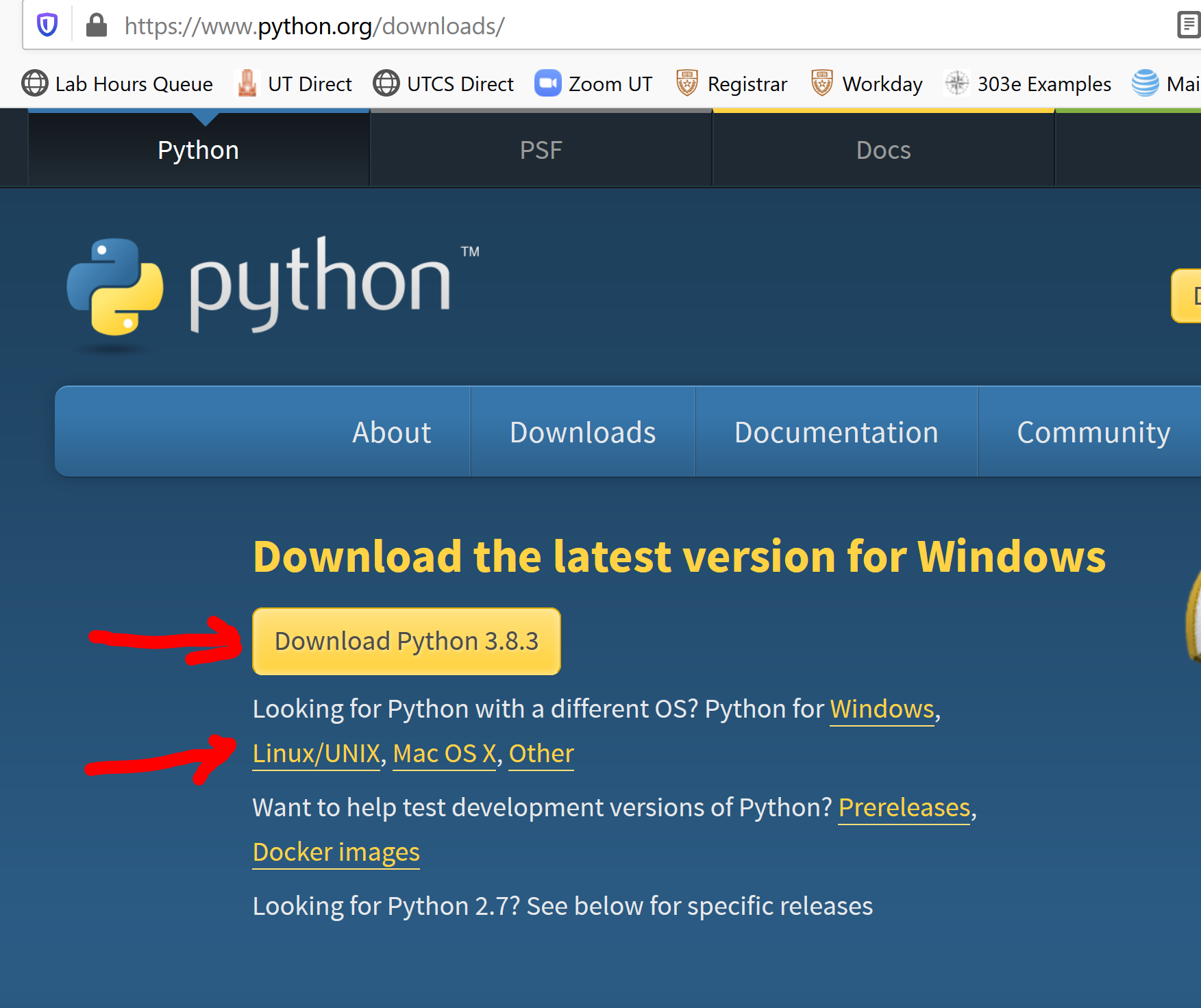
To get started with Folium, you'll need to have Python installed on your system. If you don't have Python, download and install it from the official Python website (https://www.python.org/downloads/).
Once you have Python, you can install Folium using pip, the Python package manager:
Open a command prompt or terminal window. Typepip install folium to install Folium.
If you're behind a company proxy or firewall, you may need to specify the proxy settings when installing Folium. To do this, use the following command:
pip install --proxy http://your_proxy:port/ folium
Replace "http://your_proxy:port/" with your actual proxy settings.
Verifying the Installation
After installing Folium, you can verify that it's working correctly by opening a new Python interpreter or IDLE session and importing Folium:
import folium
print(folium.version)
This should print the version number of Folium. If it doesn't, check for any errors in your installation process.
Basic Usage
Now that you have Folium installed and verified, let's create a simple map:
Open a new Python script or IDLE session. Import Folium:import folium Create a new map: m = folium.Map(location=[45, -70], zoom_start=4) The location parameter specifies the initial center point of the map in latitude and longitude (WGS84). The zoom_start parameter sets the initial zoom level. Display the map: m
This should render a basic map with a pin at the specified location.
Customizing Your Map
Folium provides many options for customizing your maps, including:
Markers: Add markers to your map using thefolium.Marker class. For example:
marker = folium.Marker([45, -70], popup='Hello World!').add_to(m)
This adds a marker with a pop-up message at the specified location.
Polygons: Draw polygons on your map using thefolium.Polygon class. For example:
poly = folium.Polygon([(40, -70), (45, -75), (50, -80)]).add_to(m)
This draws a polygon with three vertices.
Pop-ups: Add pop-up messages to your markers or polygons using thepopup parameter. GeoJSON data: Load GeoJSON data into your map using the folium.GeoJson class. Layers: Create multiple layers on your map and control their visibility using the add_to method.
Tips and Tricks
Use a Jupyter Notebook: Folium integrates seamlessly with Jupyter Notebooks, making it easy to create interactive maps and share them with others. Test Your Maps Locally: Before deploying your maps online, test them locally by saving the Python script as an HTML file and opening it in a web browser. Check the Folium Documentation: The official Folium documentation is an invaluable resource for learning more about this powerful library (https://leafletjs.com/docs/).By following these steps and tips, you'll be well on your way to creating stunning interactive maps with Folium!
Python folium show map
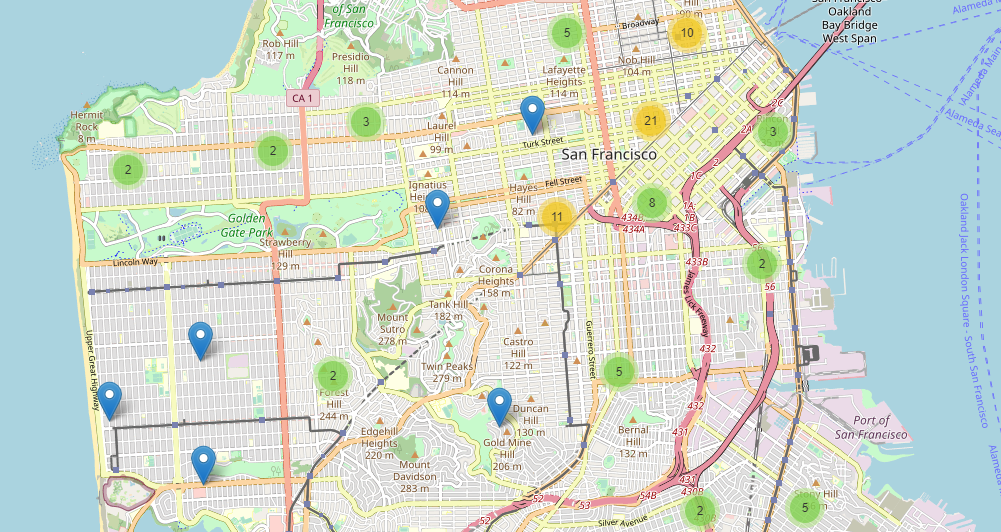
I understand that you want me to respond in English and provide a detailed explanation of how to use Python and the Folium library to create interactive maps.
What is Folium?
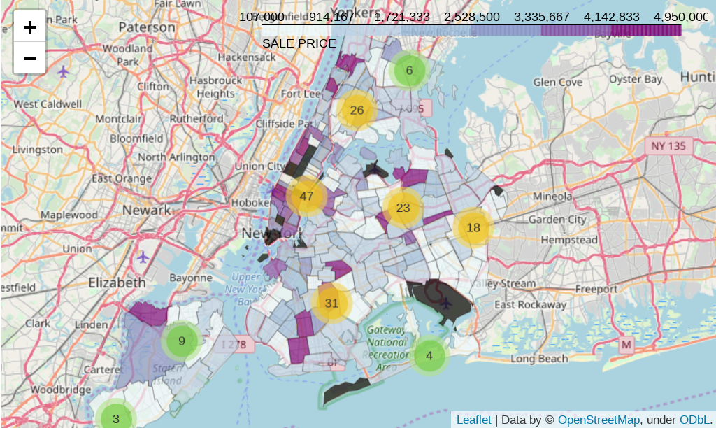
Folium is an open-source Python library that allows you to create interactive maps using HTML, CSS, and JavaScript. It's built on top of the popular Leaflet.js mapping library and provides a simple and easy-to-use API for creating custom maps. With Folium, you can create maps with markers, pop-ups, and other overlays to visualize your data.
How to Use Folium
To use Folium, you'll need to install it using pip:
pip install folium
Once installed, here's a basic example of how to create an interactive map:
Example 1: Basic Map
import folium
Create a new map with a custom zoom level
m = folium.Map(location=[40.7128, -74.0060], zoom_start=13)
Display the map as an HTML file
m.save("basic_map.html")
This code creates a basic map centered at New York City (40.7128° N, 74.0060° W) with a zoom level of 13.
Example 2: Adding Markers
import folium
Create a new map
m = folium.Map(location=[40.7128, -74.0060], zoom_start=13)
Add markers for cities in the US
cities = [
{"name": "New York City", "lat": 40.7128, "lon": -74.0060},
{"name": "Los Angeles", "lat": 34.0522, "lon": -118.2437},
{"name": "Chicago", "lat": 41.8781, "lon": -87.6298}
]
for city in cities:
folium.Marker([city["lat"], city["lon"]], popup=folium.Popup(html=f"
{city['name']}")).add_to(m)
Display the map as an HTML file
m.save("map_with_markers.html")
This code adds markers for New York City, Los Angeles, and Chicago to a new map. Each marker has a pop-up with the city's name.
Example 3: Adding Overlays
import folium
Create a new map
m = folium.Map(location=[40.7128, -74.0060], zoom_start=13)
Add an overlay for the US states
us_states = [
{"name": "New York", "lat": 43.2592, "lon": -75.8954},
{"name": "California", "lat": 38.5816, "lon": -121.4956}
]
for state in us_states:
folium.RegularPolygonMarker(
[state["lat"], state["lon"]],
number_of_sides=3,
radius=1000,
fill=True
).add_to(m)
Display the map as an HTML file
m.save("map_with_overlays.html")
This code adds overlays for the US states of New York and California. The overlays are regular polygons (in this case, equilateral triangles) with a radius of 1000 kilometers.
Conclusion
Folium is a powerful library that allows you to create interactive maps using Python. With its simple API and rich feature set, you can create custom maps with markers, pop-ups, and other overlays to visualize your data. Whether you're working on a personal project or building a commercial application, Folium is definitely worth exploring.
